


Satellite Sensor Systems in Remote Sensing
Platform
🛰️ The vehicle carrying the sensor.
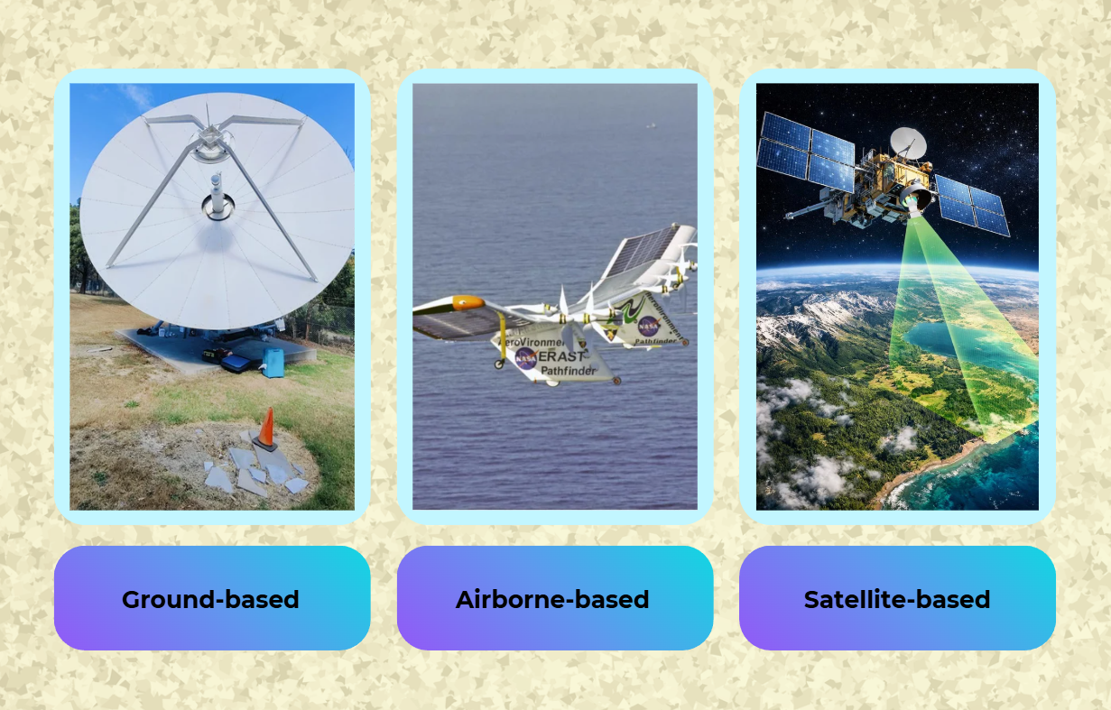
(Sources (left to right): Av-Comm; Watts et al. 2012; Graphicinsight.)
Sensor
The device capturing imagery (e.g., cameras, spectroradiometers).
One satellite can host multiple sensors (e.g., MODIS on Terra/Aqua satellites).
Active vs. Passive Sensors
Passive Sensors
- 📷 Work like advanced cameras: detect reflected sunlight/emitted radiation.
- Examples: MODIS, Landsat, Sentinel-2.
Active Sensors
- 📡 Emit their own signal (e.g., radar, LiDAR).
- Example: Sentinel-1 (radar).
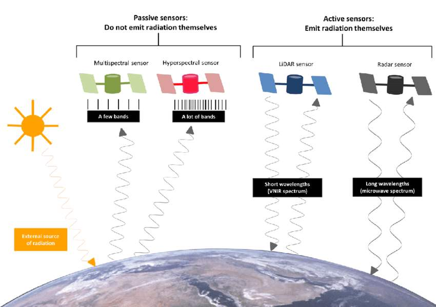
Figure: The difference between four major types of remote sensors: passive sensors (multispectral and hyperspectral) do not emit radiation themselves, but active sensors (LiDAR and radar) do. The passive modes are distinguished by the number of bands across which they measure radiance, whereas the active modes are distinguished by the wavelength of the radiation which they emit. Image: Astronaut photograph AS17-14822727 courtesy NASA Johnson Space Center Gateway to Astronaut Photography of Earth.
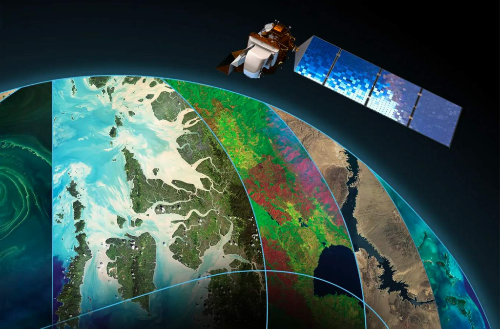
ESA’s Sentinel-2
🗓️ Launch: 2015–present
🔄 Temporal Resolution: 5 days
📏 Spatial Resolution: 10 m
🔍 Use: High-resolution agriculture and urban planning.
NASA’s MODIS
🗓️ Launch: 1999
🔄 Temporal Resolution: 1–2 days
📏 Spatial Resolution: 250 m – 1 km
🌍 Use: Daily large-scale environmental monitoring.
NASA’s Landsat Series
🗓️ Launch: 1972–present
🔄 Temporal Resolution: 16 days
📏 Spatial Resolution: 30 m (most bands)
🌳 Use: Long-term land-use and deforestation studies.
Image credit: Coldewey, D. (2022, July 28). After 50 years pioneering satellite imagery, NASA’s Landsat is ready for 50 more. TechCrunch. https://techcrunch.com/2022/07/28/after-50-years-pioneering-satellite-imagery-nasas-landsat-is-ready-for-50-more/
If you would like to know more about the concept of spatial resolution, click here.
What does the sensor capture?
To understand that, we need to understand radiation.
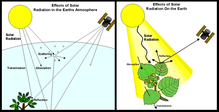
(Source: Miura Lab, University of Hawaiʻi at Mānoa.)
Scattering
Changes the direction of the radiation flow at the same wavelength; the result of complex interactions between electromagnetic radiation and particles or gases in the atmosphere; Importance of air pollution by smoke, fine sand, volcanic eruptions, etc.
Absorption
Converts the incident energy of electromagnetic radiation into “internal” energy of the absorbing molecules, thermal energy, i.e. thermal or terrestrial or long-wave radiation
Transmission
Electromagnetic radiation penetrates a body or medium
Reflection
Electromagnetic radiation is reflected without energy conversion according to the laws of reflection
Note that the values of surfaces vary greatly!
In passive, optical remote sensing, sensors capture the reflectance of a surface of short-wave (solar) radiation (visible light, VIS), near infrared (NIR), and shortwave infrared (SWIR) electromagnetic radiation. The ability of a sensor to differentiate between these different parts along the spectrum of electromagnetic radiation (electromagnetic spectrum) is called spectral resolution.
Spectral Reflectance Variation
Different surfaces (e.g., water, forest, urban areas, grassland) reflect electromagnetic radiation uniquely across the spectrum, enabling their identification.
Land cover Classification
Distinguish types and detect clear boundaries between land covers (e.g., water vs. vegetation).
Assess gradations (e.g., healthy green vegetation vs. dry/dead plant material).
Multi-Bands Analysis
Combine data from multiple spectral bands to enhance detection accuracy, eg., Infrared + red bands for vegetation health.
Spectral Indices
Mathematical formulas using band ratios to simplify complex spectral data.
There are countless indices of which the most widely used is the Normalized Difference Vegetation Index (NDVI).
Take away
Spectral reflectance differences and indices like NDVI transform raw satellite data into actionable insights about Earth’s surface. Key applications are for environmental monitoring, agriculture (crop health), urban planning, disaster response.