 Course Transcript
 EnMap
Course Transcript  Course Transcript
 Beyond the Visible – Einführung in die hyperspektrale Fernerkundung
 Course Transcript
 Beyond the Visible – Imaging Spectroscopy for Soil Applications
 Course Transcript
 Beyond the Visible – EnMAP data access and image preprocessing techniques
 Course Transcript
 Beyond the Visible – Introduction to Hyperspectral Remote Sensing
 Course TranscriptPresentation
 Beyond the Visible – Imaging Spectroscopy for Agricultural Applications
 Unit
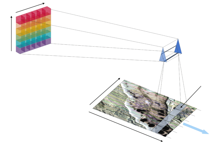
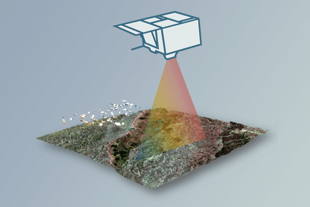
Unit Imaging spectroscopy sensor technologies
 Tutorial
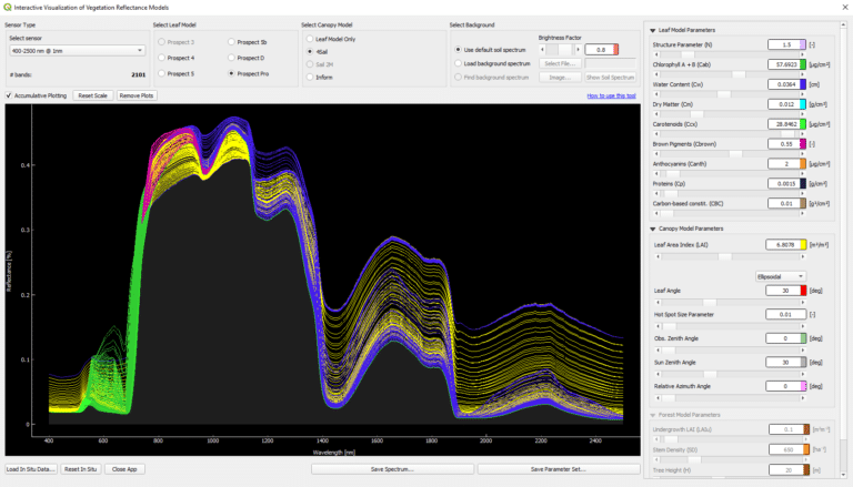
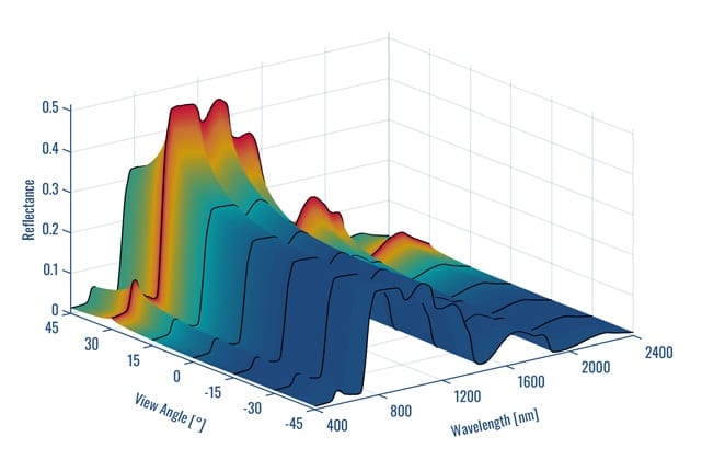
 Interactive Visualization of Vegetation Reflectance Models (IVVRM)
 Unit
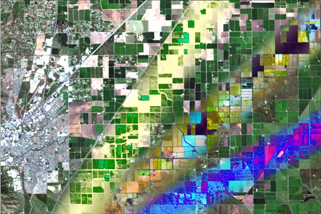
Unit Spaceborne Imaging Spectroscopy of Agricultural Systems
 Unit
Unit Sensor simulation
 Unit
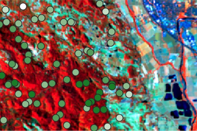
Unit Imaging spectroscopy of forest ecosystems
 Unit
Unit Retrieval approaches of vegetation traits from imaging spectroscopy data
 Tutorial
 Regression-based mapping of forest aboveground biomass
 Unit
Unit Dimensionality reduction of imaging spectroscopy data
 Tutorial
 Regression-based unmixing of urban land cover
EnMAP-Box
 Unit
Unit