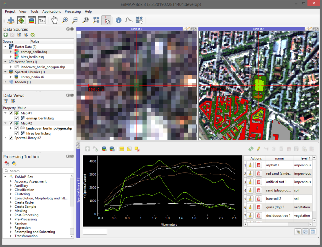
The EnMAP-Box is a free and open source plug-in for QGIS to visualize and process remote sensing raster data. It was particularly developed to handle imaging spectroscopy data, as expected from the upcoming EnMAP sensor.
Highlights of EnMAP-Box
- an easy-to-use graphical user interface for the visualization of vector and raster data sources in parallel as well as in spatially linked maps
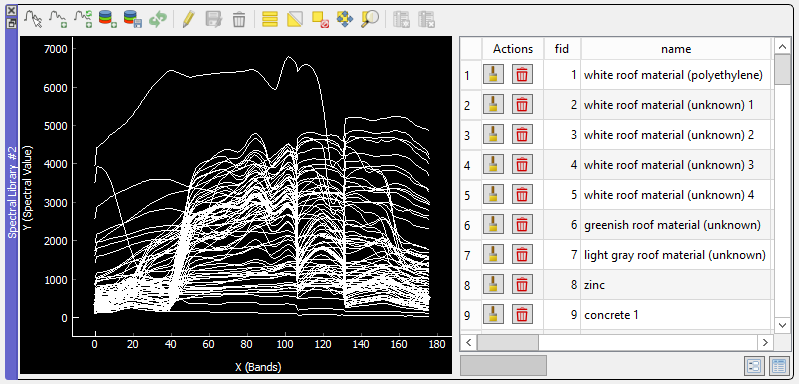
- collection and visuzalisation of spectral profiles in spectral libraries. Spectral profiles can come from different sources, e.g. raster images, field spectrometer or table-sheets.
- enhances the QGIS processing framework with many algorithms commonly used in remote sensing and imaging spectroscopy, e.g. support for vector machines or random forest based raster classification, regression, cluster approaches from the scikit-learn library.
- applications specific to imaging spectroscopy and the EnMAP program, e.g. the simulation of spectral profiles, atmospheric correction of EnMAP data, mapping of geological classes from EnMAP data, and more…
License
The EnMAP-Box is released under the GNU General Public License (GPL) Version 3 or above. A copy of this licence can be found at http://www.gnu.org/licenses/gpl.html.