 Course Transcript
 Methods
Course Transcript  Course Transcript
 Beyond the Visible – Einführung in die hyperspektrale Fernerkundung
 Talk
Talk ESA BIOMASS: Bridging Models and Observation
 Talk
Talk ESA BIOMASS: Exploratory Model-Data Integration Exercises
 Talk
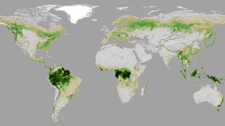
Talk ESA BIOMASS: From AGB to Terrestrial Carbon Cycle
 Talk
Talk ESA BIOMASS: Simulation and Analysis of Forest Factory RTM
 Talk
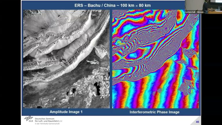
Talk ESA BIOMASS: SAR Interferometry – Forest Height – Do It Yourself
 Talk
Talk ESA BIOMASS: SAR Interferometry – The Way To 3D Forest Structure
 Podcast
 Use of X-band SAR for Surveillance and Reconnaissance with High-Resolution Imaging in Defense Applications
 Podcast
 Advanced Ship Detection Using X-band SAR
 Podcast
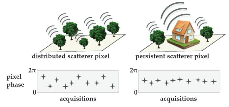
 X-band for Persistent Scattering Interferometry
 Podcast
 X-band for air traffic control
 Podcast
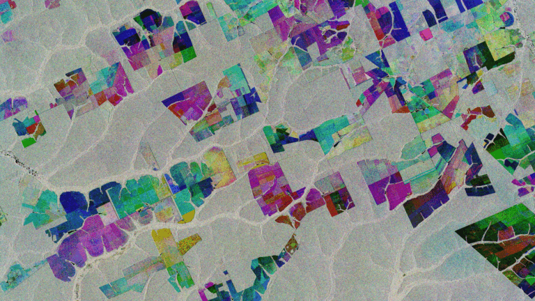
 Synergistic Use of SAR for Crop Classification
Synergistic Use of SAR for Biomass Estimation
 Podcast
 Radar bands synergy: The Synergistic Use of P-band, L-band, C-band, and X-band in Radar Remote Sensing
Calibration and Validation (Cal/Val) Activities in Earth Observation Missions like ESA Biomass
The Future of Remote Sensing with Artificial Intelligence
 Course Transcript
 Beyond the Visible – Imaging Spectroscopy for Soil Applications
 Course Transcript
 Beyond the Visible – EnMAP data access and image preprocessing techniques
 Course Transcript
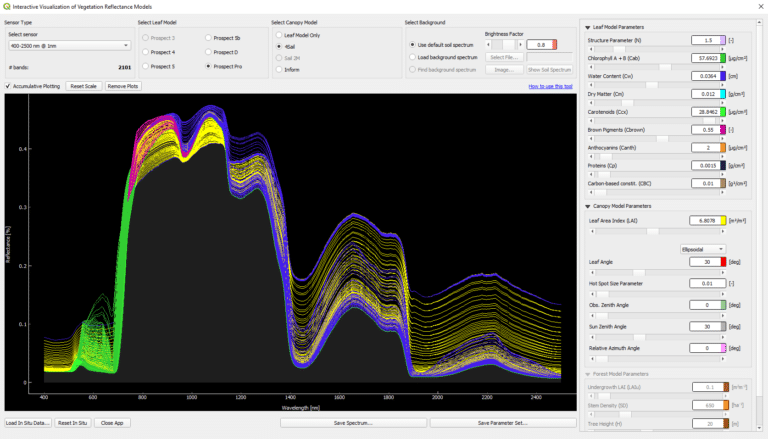
 Beyond the Visible – Introduction to Hyperspectral Remote Sensing
 Course TranscriptPresentation
 Beyond the Visible – Imaging Spectroscopy for Agricultural Applications
 Tutorial
 Large-scale EO data handling
 Presentation
 ESA BIOMASS mission overview
 Tutorial