Introduction
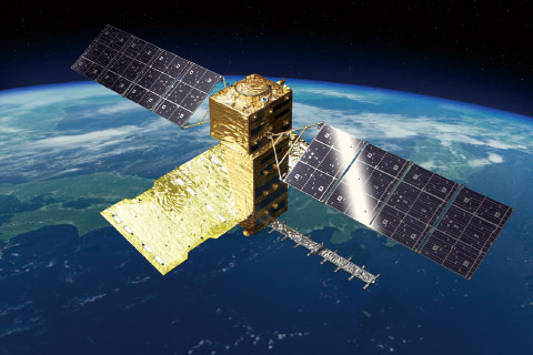
The Advanced Land Observing Satellite (ALOS) program, developed by the Japan Aerospace Exploration Agency (JAXA), is one of Japan’s most important contributions to global Earth observation. Since its start, ALOS has been a key player in providing satellite data for many applications, such as disaster management, environmental monitoring, natural resource management, and precision agriculture. Its use of L-band Synthetic Aperture Radar (SAR) and high-resolution optical sensors has helped researchers and decision-makers address some of the world’s most pressing environmental and societal challenges.
In response to growing global issues like climate change, more frequent natural disasters, and environmental degradation, JAXA is advancing its ALOS program with ALOS-3 and ALOS-4. These next-generation satellites will offer higher spatial resolution, faster revisit times, and an expanded range of uses. The future of ALOS is also closely tied to Japan’s broader Earth observation strategy and global initiatives like the Global Earth Observation System of Systems (GEOSS) and the Committee on Earth Observation Satellites (CEOS). Through these partnerships, ALOS will continue contributing to climate monitoring, sustainable development, and disaster resilience worldwide.
Evolution of the ALOS Program
ALOS-1 and ALOS-2: Building the Foundation
The program began with ALOS-1, launched in 2006. It collected high-resolution optical and L-band SAR data until 2011. This satellite played a major role in topographic mapping, disaster monitoring, and environmental management. Following its success, ALOS-2 was launched in 2014. This satellite featured the improved PALSAR-2 sensor, offering better spatial resolution and more frequent coverage. ALOS-2 has since become an essential tool for flood mapping, ground deformation monitoring, and forest biomass assessment.
Today, ALOS-2 remains active, providing valuable data for disaster risk reduction, ecosystem monitoring, and agriculture. Its data supports programs like Sentinel Asia, helping countries in the Asia-Pacific region better manage disasters and protect their environments.
The Next Generation: ALOS-3 and ALOS-4
ALOS-3: Enhancing Optical Earth Observation
ALOS-3 marks a shift back to high-resolution optical Earth observation. Unlike earlier ALOS missions focused on radar, ALOS-3 will deliver:
- Panchromatic images at 0.8-meter resolution and multispectral images at 3.2-meter resolution.
- Applications such as land use mapping, urban planning, disaster response, precision agriculture, and environmental monitoring.
Although originally planned for launch in 2023, ALOS-3’s deployment has been delayed. Once operational, it will complement ALOS-4, providing integrated radar and optical data for more comprehensive Earth observation.
ALOS-4: Evolving SAR Capabilities
ALOS-4 builds on the success of ALOS-2, continuing JAXA’s leadership in L-band SAR Earth observation. Featuring PALSAR-3, ALOS-4 will deliver:
- Higher resolution images.
- Wider swath coverage.
- Faster data acquisition rates.
The satellite’s key applications will include:
- Disaster monitoring (earthquakes, floods, and landslides).
- Forest biomass monitoring and deforestation detection, contributing to climate initiatives like REDD+.
- Maritime surveillance, including ship detection, illegal fishing monitoring, and oil spill response.
ALOS-4 is scheduled to launch in 2024, pending final readiness checks.
Key Trends and Future Directions in the ALOS Program
1. Next-Generation SAR Technologies
Future ALOS missions will focus on enhancing SAR capabilities, including:
- Improved spatial resolution (potentially sub-meter in future systems).
- Wider swath widths for larger area monitoring.
- Multi-polarization and full polarimetric imaging for better vegetation analysis and land classification.
- The potential addition of multi-frequency SAR systems (S-band or P-band) to support applications like biomass estimation and geology studies.
2. Faster Revisit Times and Near-Real-Time Access
Reducing revisit intervals will make future ALOS missions more responsive to fast-changing situations, such as natural disasters and rapid urban development. Onboard data processing and near-real-time data delivery will support emergency decision-making and disaster response operations.
3. Disaster Risk Reduction (DRR) and Crisis Monitoring
Japan’s exposure to natural hazards makes DRR a top priority for the ALOS program. Future missions will provide:
- Real-time monitoring of ground deformation (using InSAR techniques) after earthquakes.
- Cloud-penetrating flood detection.
- Landslide monitoring and early warning systems.
- Integration with regional and global initiatives like Sentinel Asia, GEOSS, and CEOS to strengthen international disaster response networks.
4. Climate Change and Environmental Monitoring
ALOS will play a vital role in climate change research and mitigation by:
- Tracking deforestation and forest degradation, particularly for REDD+ and carbon stock monitoring.
- Measuring wetland areas and health, which are key for maintaining biodiversity and carbon storage.
- Observing coastal erosion, glacier retreat, and ice sheet changes, which are important indicators of climate change impacts.
5. Maritime Surveillance and National Security
The future ALOS program will contribute to Japan’s maritime security through:
- Ship detection and tracking in Japan’s Exclusive Economic Zone (EEZ).
- Monitoring illegal fishing and enforcing maritime regulations.
- Detecting oil spills and supporting environmental protection in marine areas.
6. Global Collaboration through GEOSS and CEOS
Japan’s contributions to GEOSS and CEOS will expand as ALOS missions continue. These collaborations will:
- Promote data standardization and interoperability with systems like Copernicus and NASA’s Earth Observing System.
- Enable international research on climate variables, ecosystem changes, and hazard monitoring.
- Make ALOS data more widely available through open data initiatives.
7. Data Accessibility and Democratization
JAXA aims to make ALOS data more accessible to a wide range of users by:
- Providing easy access through open data platforms and cloud services.
- Offering pre-processed and analysis-ready data products.
- Encouraging SMEs and startups to use ALOS data for commercial applications, such as agriculture, insurance, and urban development.
8. AI and Advanced Data Processing
Future ALOS satellites will use Artificial Intelligence (AI) and Machine Learning (ML) to:
- Automatically detect changes and anomalies, such as land cover changes or disaster impacts.
- Enable smart tasking of observation targets based on real-time events.
- Accelerate data processing and delivery, providing faster insights for decision-makers.
Broader JAXA Earth Observation Initiatives Supporting ALOS
In addition to ALOS, JAXA runs other important Earth observation missions, including:
- GOSAT and GOSAT-2, which monitor greenhouse gas concentrations worldwide.
- GCOM-W and GCOM-C, which focus on the global water cycle and climate variables.
- EarthCARE, a joint project with ESA to study clouds, aerosols, and their effects on the Earth’s climate.
JAXA is also exploring satellite constellations and geostationary systems for continuous disaster monitoring and environmental observation.
Conclusion
The ALOS program remains central to Japan’s space-based Earth observation strategy. ALOS-3 and ALOS-4 will deliver essential data to help address climate change, improve disaster preparedness, and promote sustainable development. JAXA’s integration of AI, advanced SAR technologies, and open data policies ensures that ALOS will remain a critical tool in global Earth observation networks.
By supporting international initiatives like GEOSS and CEOS, ALOS data will continue to empower researchers, governments, and industries to make better-informed decisions. Looking forward, the ALOS program demonstrates Japan’s commitment to innovation, collaboration, and sustainable Earth observation for the benefit of future generations.
Expand Your Knowledge – Dive Deeper
- Land in Focus – Hazards and Disasters
- Echoses in Space We particularly recommend topics Forest applications, Forest Tutorial Saving lives when disaster strikes, Introduction to Flood Mapping and Flood mapping tutorial
Further Reading
- ALOS-3 (Advanced Land Observing Satellite-3)
- Status of Advanced Land Observing Satellite-4 “DAICHI-4” (ALOS-4)
- Miura, S. H., Kankaku, Y., Motohka, T., Arikawa, Y., & Suzuki, S. (2022, October). ALOS-4/PALSAR-3 current status. In Sensors, Systems, and Next-Generation Satellites XXVI (Vol. 12264, pp. 50-58). SPIE.
- Japan’s H3 Rocket Launches ALOS-4 Satellite
- JAXA ALOS-4 Mission Overview
- Balling, J., Slagter, B., van der Woude, S., Herold, M., & Reiche, J. (2024). ALOS-2 PALSAR-2 ScanSAR and Sentinel-1 data for timely tropical forest disturbance mapping: A case study for Sumatra, Indonesia. International Journal of Applied Earth Observation and Geoinformation, 132, 103994.
Responses