 Course Transcript
 Applications
Course Transcript  Talk
Talk ESA BIOMASS: Bridging Models and Observation
 Talk
Talk ESA BIOMASS: Exploratory Model-Data Integration Exercises
 Talk
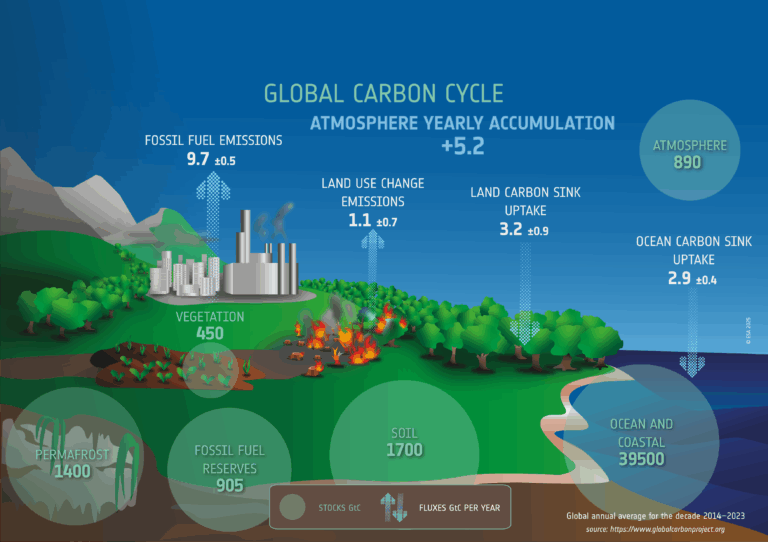
Talk ESA BIOMASS: From AGB to Terrestrial Carbon Cycle
 Talk
Talk ESA BIOMASS: Understanding and Forecasting the Terrestrial Carbon Cycle Inferring Process Dynamics from Biomass Data
 Talk
Talk ESA BIOMASS: Simulation and Analysis of Forest Factory RTM
 Talk
Talk ESA BIOMASS: Modelling Amazon Rainforest Responses to Environmental Change
Talk
ESA BIOMASS: Hands On Exercise Biomass Products
 Talk
Talk ESA BIOMASS: How Do Biomass Mission Products Compare to Other Biomass Products?
 Talk
Talk ESA BIOMASS: SAR Interferometry – Forest Height – Do It Yourself
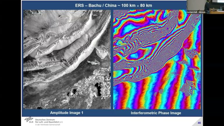 Talk
Talk ESA BIOMASS: SAR Interferometry – The Way To 3D Forest Structure
 Talk
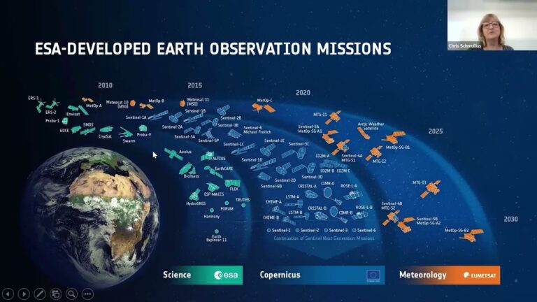
Talk ESA BIOMASS: Overview
 Podcast
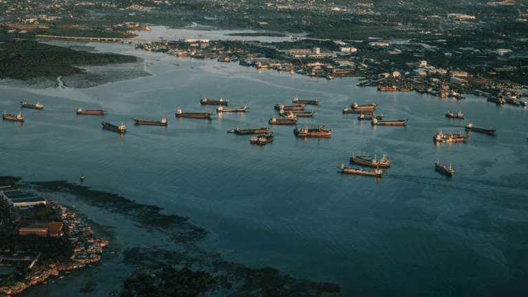
 Advanced Ship Detection Using X-band SAR
 Podcast
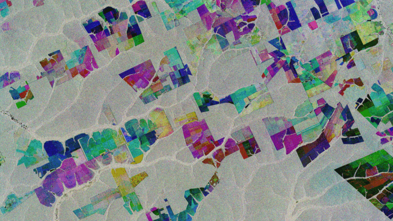
 Synergistic Use of SAR for Crop Classification
Synergistic Use of SAR for Biomass Estimation
 Podcast
 P-band for measuring glacier and ice sheet velocities
 Podcast
 P-Band for forestry applications – Biomass Estimation and Forest Height Measurement
 Podcast
 P-band for elevation mapping under forest
 Podcast
 From MAAP to ASCEND
 Unit
Unit Spaceborne imaging spectroscopy of aquatic ecosystems
 Course Transcript
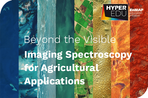
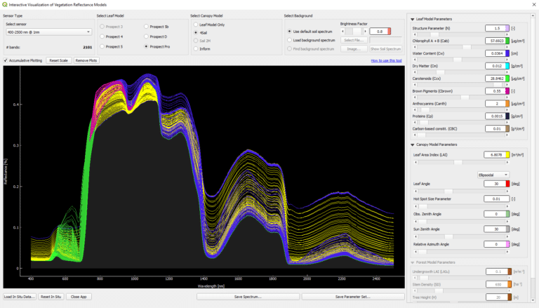
 Beyond the Visible – Imaging Spectroscopy for Agricultural Applications
 Presentation
 ESA BIOMASS mission overview
 Unit
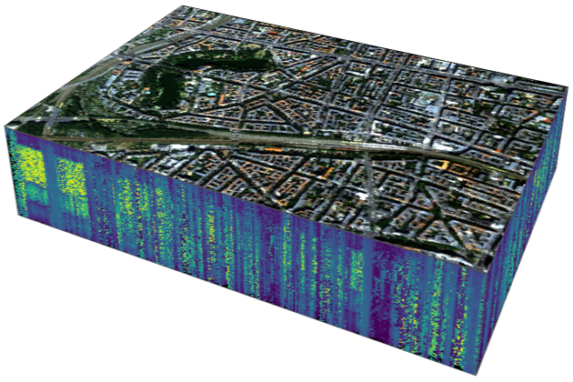
Unit Imaging spectroscopy for urban mapping
 Tutorial