
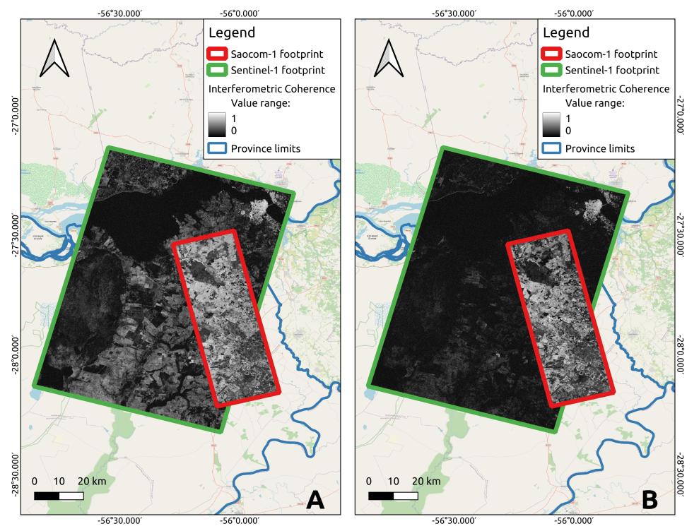
Interferometric coherence derived from SAOCOM-1 L-band SAR can be used for forestry applications. The quality of products derived from interferometric SAR data depends on the temporal and spatial baselines of the system. SAOCOM-1 offers comparably short temporal baselines. Scientific studies found that SAOCOM-1 L-band interferometric data pairs provide higher coherence values and are less sensitive to temporal decorrelation compared to Sentinel-1 C-band data, making them more suitable for forest studies (Seppi et al. 2022).
SAOCOM-1 SAAR data are used for:
- Assessing forest structure, height, biomass, and health
- Monitoring of deforestation
- Managing forest resources.
Hydrology and Water Management
- Monitoring soil moisture levels across vast areas
- Supporting water management and irrigation practices
- Contributing to flood prediction models
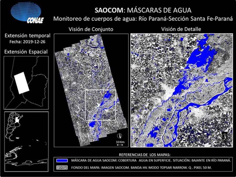
- Detection and monitoring of snow packsWater MasksThe new technology offered by SAOCOM satellites allows for the detection of water-saturated or waterlogged surfaces, which are not usually captured by optical satellites due to crop cover. Likewise, SAR technology allows for tracking the dynamics of water bodies in wet and drought periods.
Geology and Land Monitoring
- Generation of DEMs
- Persistent Scattering Interferometry
- Detecting ground movement and subsidence, which is crucial for infrastructure monitoring, mining, and detecting potential landslides or geological hazards.
Disaster Response
- Providing critical information for disaster management, including flood mapping and assessing damage after natural disasters.
Marine Applications
- Oil spill detection
- Ship detection