
Sentinel-1 data access
How can I obtain free radar data?
Within the framework of the Copernicus Programme of the European Commission, Sentinel data is freely accessible to anyone.
As we have learned, the Sentinel family includes two radar satellite constellation Sentinel-1A & -1B, operating at C-Band. In this topic you will learn how to obtain the data, which imaging modes are available and which product level will best suit to your desired application.

By loading the video, you agree to YouTube’s privacy policy.
Learn more
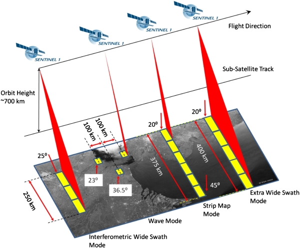
Sentinel-1 Image modes
Information on the different imaging modes of Sentinel-1, according to the Sentinel-1 Acquisition mode documentation.

Stripmap (SM)
(80 km Swath width | 5 by 5 m resolution)
Stripmap mode acquires data with an 80 km swath at 5 m by 5 m spatial resolution (single look). The ground swath is illuminated by a continuous sequence of pulses while the antenna beam is pointing to a fixed azimuth angle and an approximately fixed off-nadir angle. SM images have continuous along track image quality at an approximately constant incidence angle.
Polarisation modes
- Dual (HH+HV, VV+VH)
- Single (HH, VV)

Interferometric Wide Swath (IW)
(250 km Swath width | 5 by 20 m resolution)
The Interferometric Wide swath mode is the main acquisition mode over land and satisfies the majority of service requirements. It acquires data with a 250 km swath at 5 m by 20 m spatial resolution (single look).
Azimuth resolution is reduced compared to SM due to the shorter target illumination time of the burst. IW mode captures three sub-swaths using Terrain Observation with Progressive Scans SAR (TOPSAR). Bursts are synchronised from pass to pass to ensure the alignment of interferometric pairs.
With the TOPSAR technique, in addition to steering the beam in range as in ScanSAR, the beam is also electronically steered from backward to forward in the azimuth direction for each burst, avoiding scalloping and resulting in homogeneous image quality throughout the swath.
Polarisation modes
- Dual (HH+HV, VV+VH)
- Single (HH, VV)
Extra Wide Swath (EW)
(400 km Swath width | 20 by 40 m resolution)
Similar to the IW mode, the Extra Wide swath mode employs the TOPSAR technique to acquire data over a much wider area using five sub-swaths. EW mode acquires data over a 400 km swath at 20 m by 40 m spatial resolution.
EW SLC products contain one image per sub-swath and one per polarisation channel, for a total of five (single polarisation) or 10 (dual polarisation) images in an EW product.
The EW mode is aimed primarily for use over sea-ice, polar zones and certain maritime areas, in particular for ice, oil spill monitoring and security services. Like IW, EW mode can also be used for interferometry since it shares the same characteristics for burst synchronisation, baseline and Doppler stability.
Polarisation modes
- Dual (HH+HV, VV+VH)
- Single (HH, VV)
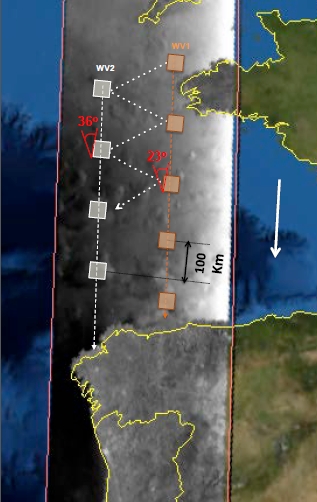
Wave Mode (WV)
(20 km Swath width | 5 by 5 m resolution)
Wave mode acquires data in 20 km by 20 km vignettes, at 5 m by 5 m spatial resolution, every 100 km along the orbit, acquired alternately on two different incidence angles. Vignettes on the same incidence angle are separated by 200 km.
SENTINEL-1 Wave mode is similar to ERS and ENVISAT wave mode imaging but with improved resolution, larger vignettes and a new ‘leap frog’ acquisition pattern. WV acquisitions consist of several vignettes exclusively in either VV or HH polarisation, with each vignette processed as a separate image. WV mode products can contain any number of vignettes, potentially amounting to an entire data-take. Each vignette will be contained in an independent image within the product.
Polarisation modes
- Single (HH, VV)
Excursion: Sentinel-1 Product levels
Radar images are available at different processing levels. That means that a certain amount of pre-processing has already been conducted by the data provider in each product level. It is important to know which processing steps have been done at each level before ordering the data. For many users it is advantageous to order high processing levels to reduce the effort of working with the data. For others, especially scientific users, it is desirable to order data as close to the RAW data as possible to enable customized processing.
If you are interested in learning about the Sentinel-1 processing levels, click the ‘Show More’ button and discover the product levels of Sentinel-1, as described by the Sentinel-1 Product level documentation.
Show More

Inlcuded | Not included
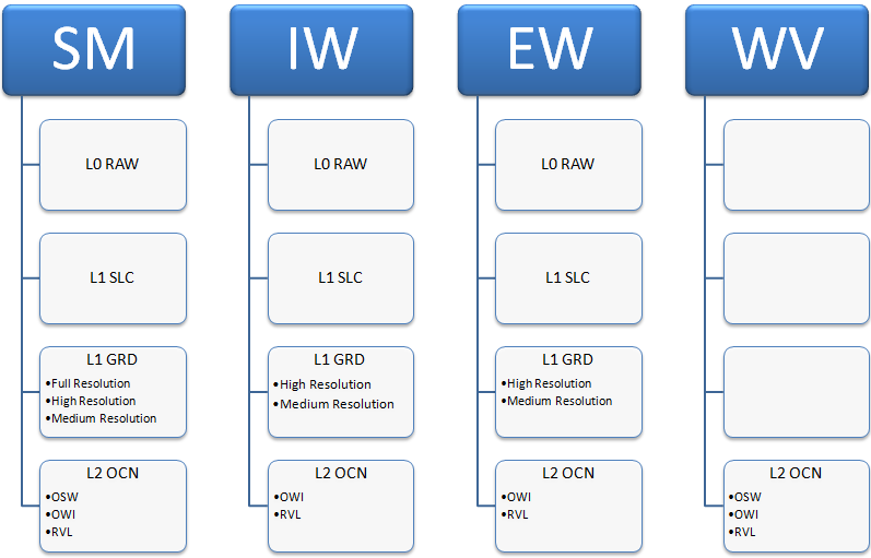
Level 0
The SAR Level-0 products consist of compressed and unfocused SAR raw data. Level-0 products are the basis from which all other high level products are produced. For the data to be usable, it will need to be decompressed and processed using focusing software.
Level-0 data includes noise, internal calibration and echo source packets as well as orbit and attitude information.
Level-0 products are stored in the long term archives. They can be processed to generate any type of product during the mission lifetime and for 25 years after the end of the space segment operations.
Level-0 products are available to data users for only the SM, IW and EW modes.
Level 1
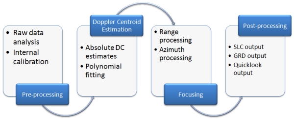
Level-1 focused data are the generally available products intended for most data users. The Level-0 product is transformed into a Level-1 product by the application of algorithms and calibration data to form a baseline engineering product from which higher levels are derived.
The processing involved to produce Level-1 data products includes pre-processing, Doppler centroid estimation, single look complex focusing, and image and post-processing for generation of the SLC and GRD products as well as mode specific processing for assembling of multi-swath products.
Level-1 products can be either Single Look Complex (SLC) or Ground Range Detected (GRD). Each acquisition mode can potentially generate Level-1 SLC and GRD products. GRD resolutions will depend on the mode and the level of multi-looking.
Single Look Complex
Level-1 Single Look Complex (SLC) products consist of focused SAR data, geo-referenced using orbit and attitude data from the satellite, and provided in slant-range geometry. Slant range is the natural radar range observation coordinate, defined as the line-of-sight from the radar to each reflecting object. The products are in zero-Doppler orientation where each row of pixels represents points along a line perpendicular to the sub-satellite track.
The products include a single look in each dimension using the full available signal bandwidth and complex samples (real and imaginary) preserving the phase information. The products have been geo-referenced using the orbit and altitude data from the satellite and have been corrected for azimuth bi-static delay, elevation antenna pattern and range spreading loss.
Ground Range Detected
Level-1 Ground Range Detected (GRD) products consist of focused SAR data that has been detected, multi-looked and projected to ground range using an Earth ellipsoid model such as WGS84. The ellipsoid projection of the GRD products is corrected using the terrain height specified in the product general annotation. The terrain height used varies in azimuth but is constant in range.
Ground range coordinates are the slant range coordinates projected onto the ellipsoid of the Earth. Pixel values represent detected magnitude. Phase information is lost. The resulting product has approximately square resolution pixels and square pixel spacing with reduced speckle at a cost of reduced geometric resolution.
Level 2
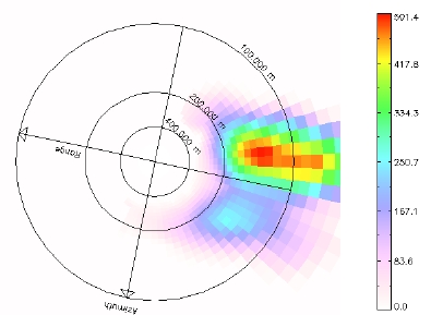
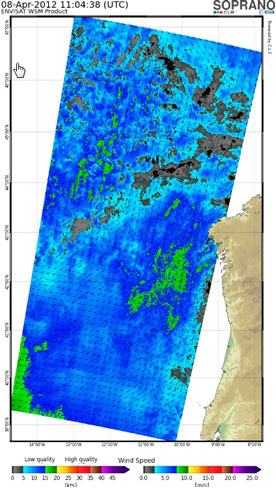
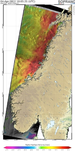
Level-2 consists of geolocated geophysical products derived from Level-1. Level-2 Ocean (OCN) products for wind, wave and currents applications may contain the following geophysical components derived from the SAR data:
- Ocean Wind field (OWI)
- Ocean Swell spectra (OSW)
- Surface Radial Velocity (RVL).
The availability of components depends on the acquisition mode. The metadata referring to OWI are derived from an internally processed GRD product, the metadata referring to RVL (and OSW, for SM and WV mode) are derived from an internally processed SLC product.
OSW Spectra (image courtesy of CLS SOPRANO)
Wind Speed Plot (image courtesy of CLS SOPRANO)
Surface Radial Velocity (image courtesy of CLS SOPRANO)
(Free) Radar Data Sources
The following list gives you an overview where to obtain free and commercial radar data from various institutions.
Earth Explorer
U.S. Geological Service
The Earth Explorer is a service provided by the USGS. It holds a vast archive of Earth observation data. Amongst several optical data sets and Digital Elevation Models, the following radar sensors and products can be found:
- SIR-C
- SRTM
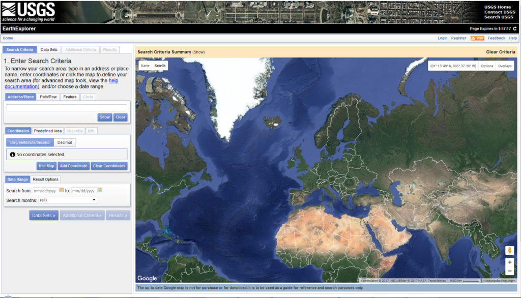
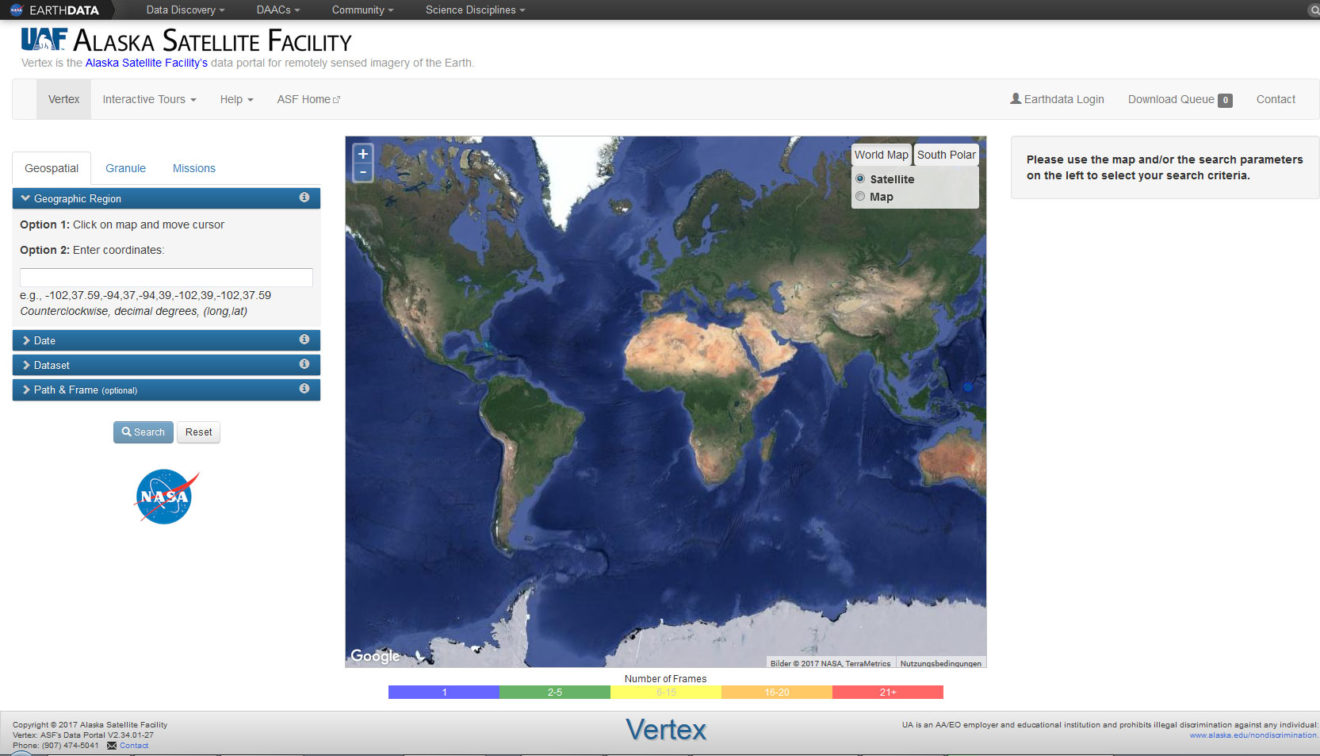
Vertex
Alaska Space Facility
Possibly one of the world’s largest repository for Earth observation data. The data portal of the Alaska Space Facility offers access to the following radar data sets:
- Sentinel-1
- NASA UAVSAR
- ALOS PALSAR
- Radarsat-1
- ERS-1/-2
- JERS-1
- AIRSAR
- SeaSat
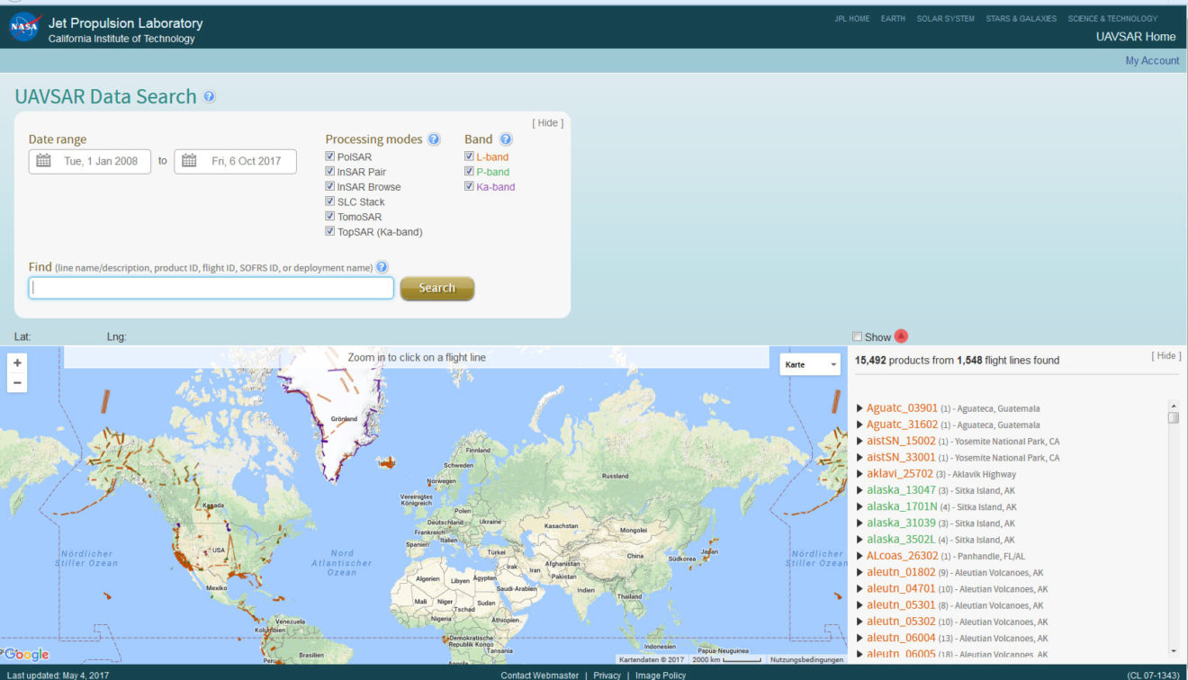
JPL UAVSAR
Jet Propulsion Laboratory
NASA JPL provides access to its Uninhabited Aerial Vehicle Synthetic Aperture Radar (UAVSAR) data.
- NASA UAVSAR
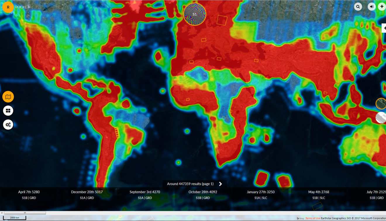
Rocket
Mashup
The web portal Rocket provides the opportunity to download data from all the Sentinels as well as other sensors. In terms of radar data, Rocket provides:
- Sentinel-1
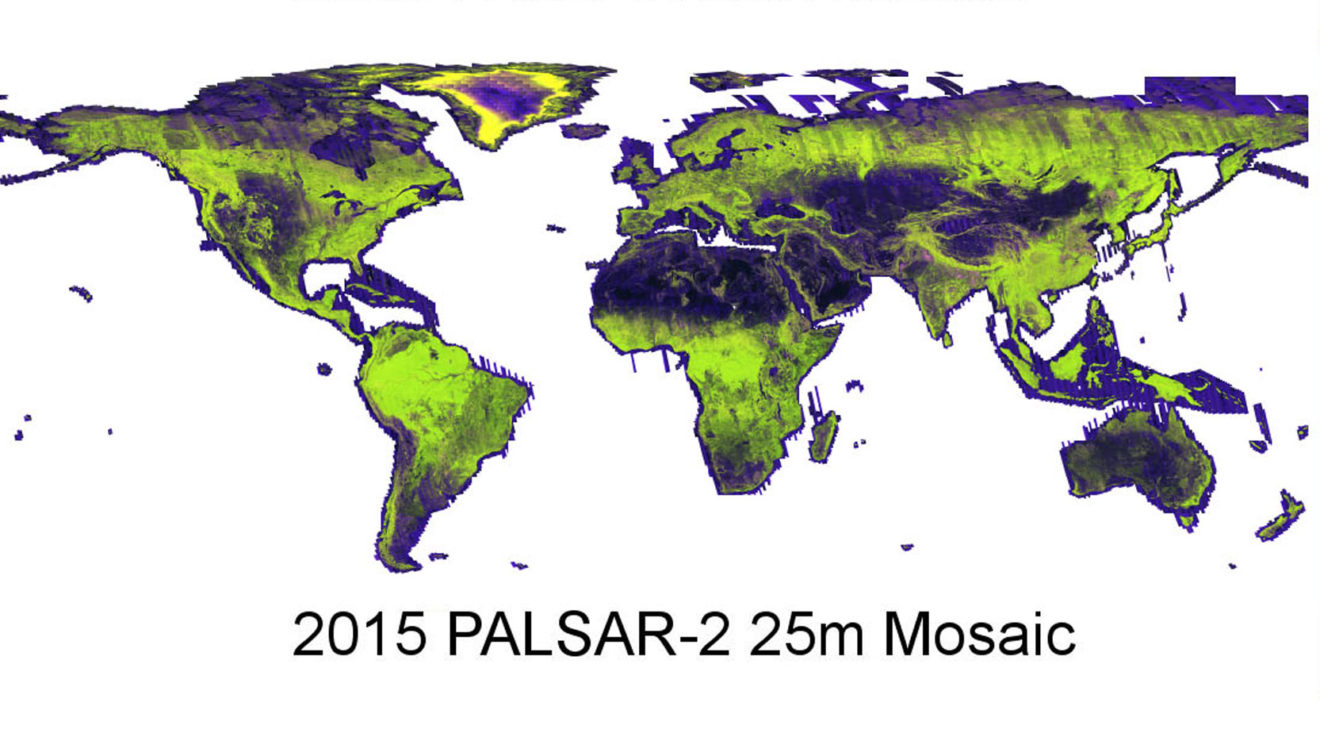
ALOS PALSAR Mosaic
Japanese Aerospace Exploration Agency
JAXA provides access to global mosaics of ALOS PALSAR as well as forest/non-forest maps derived from this data.
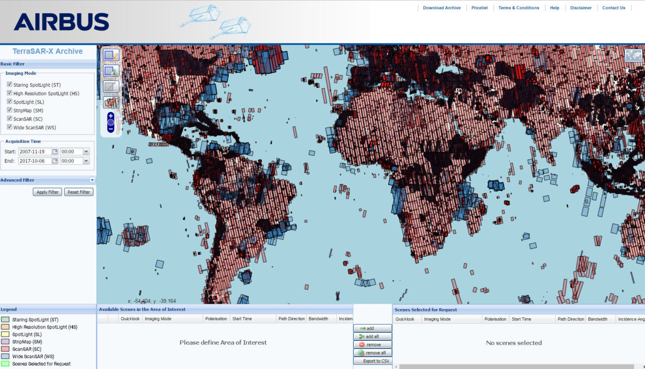
TerraSAR-X
Airbus Defence & Space
The company Airbus, which developed TerraSAR- and TanDEM-X in collaboration with the German Aerospace Center, provides a data archive where data can be searched and ordered.
- TerraSAR-X
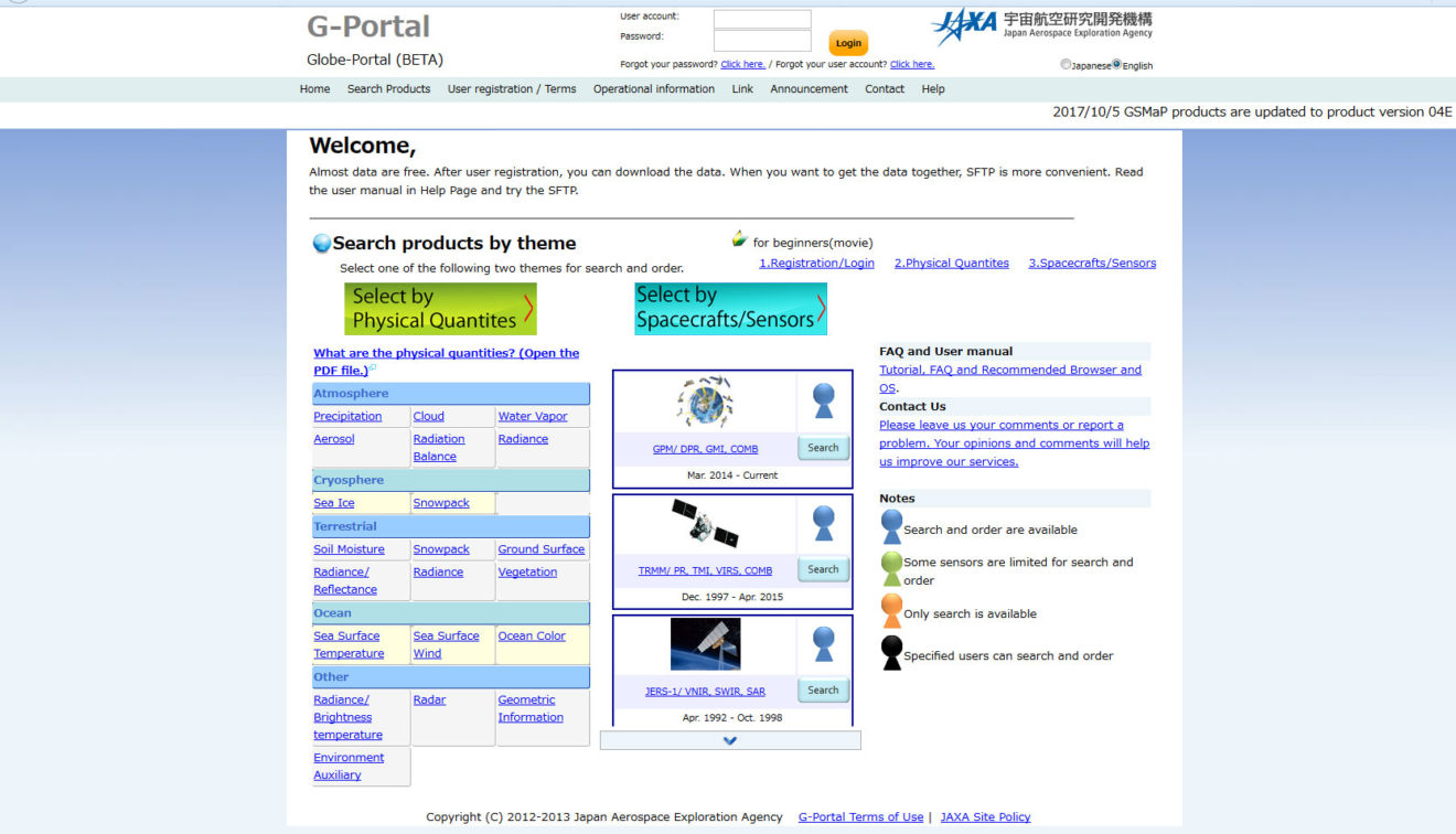
G-Portal
Japanese Aerospace Exploration Agency
JAXA provides another data portal where radar data can be searched and ordered.
- JERS-1
- ALOS-1
- ALOS-2
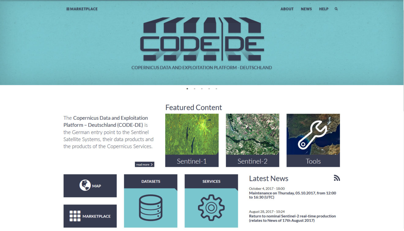
CODE-DE
German Aerospace Center
The Copernicus Data and Exploitation Platform – Deutschland (CODE-DE) is the German entry point to the Sentinel Satellite Systems, their data products and the products of the Copernicus Services.
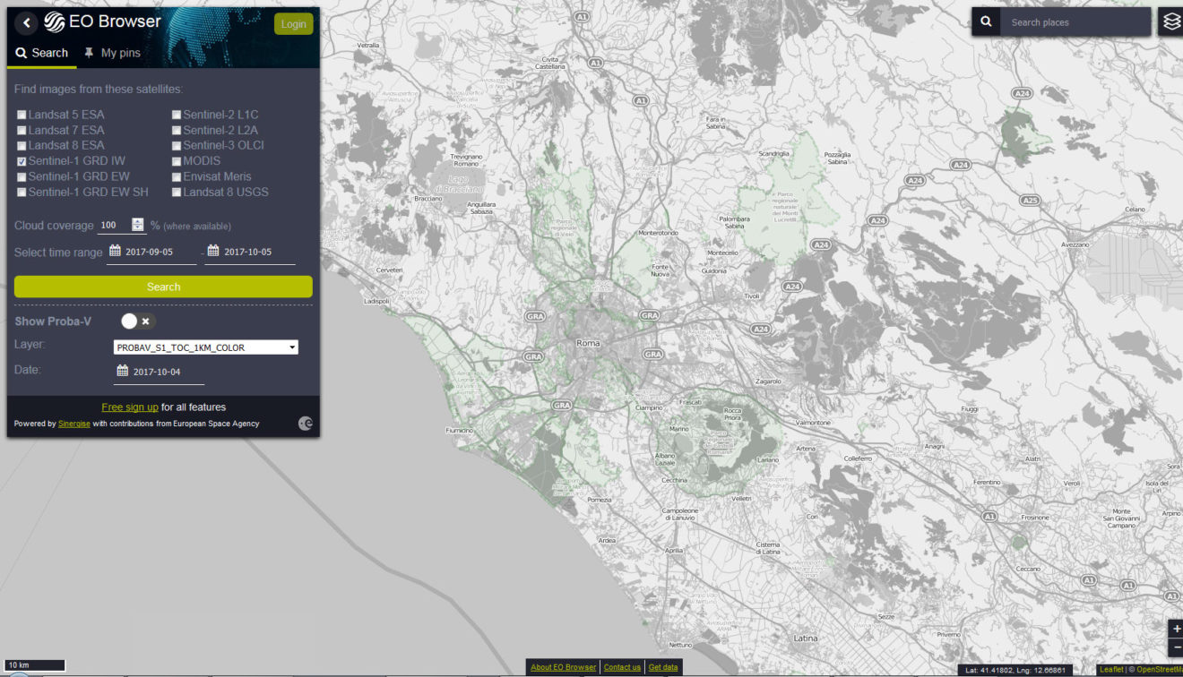
EO Browser
Sinergise
The EO browser is a tool to search, process and visualise Sentinel data, including Sentinel-1. It is very useful to produce maps quickly and easily.
Even more Data Sources
Here is a very comprehensive list of data mirrors and tools for Sentinel images.
Data Access
Data Hubs and National Mirrors
Official datahubs and mirrors by the Copernicus partners and Collaborative Ground Segment members.
- Copernicus Open Access Hub (SciHub)
- Australia National Mirror
- Austria National Mirror
- Finland National Mirror
- France National Mirror (PEPS)
- Germany National Mirror (CODE-DE)
- Greece National Mirror
- Italy National Mirror
- Norway National Mirror
- Portugal National Mirror
- Sweden National Mirror (SWEA)
- United Kingdom National Mirror (SEDAS)
Partial Mirrors
Innitiatives to integrate specific Sentinel data into existing search and discovery platforms.
- Alaska Satellite Facility (Sentinel-1)
- Centre for Environmental Data Analysis – CEDA (Sentinel-1, -2)
- Theia (Sentinel-2)
- atmospherically corrected L2A products covering several European countries and areas proposed by scientists
- published less than two days after L1C is available
- USGS EarthExplorer (Sentinel-2)
- EUMETSAT CODA (Sentinel-3 Marine Products)
- 14 day rolling archive of Sentinel-3 L1 and L2 marine products in near real-time (NRT), short time critical (STC) and non time critical (NTC) latency mode
Cloud Providers
Providers that host Copernicus Sentinel data and allow you to bring your own code to process it.
- Amazon Web Services (Sentinel-2)
- public S3 bucket, Sentinel-2 only, hosted in region eu-central-1 (Frankfurt)
- Google (Sentinel-2)
- public Google Cloud Storage bucket,
.SAFEformat, EU region
- public Google Cloud Storage bucket,
- Planet
- Sentinel-2 included in commercial API
Tools
Specific to Copernicus Sentinel data discovery, download and processing.
Search & Download
sentinelsat- search and download from any Datahub. Comes with an intuitive command line and a flexible Python API.
Sentinel-download- download Sentinel-2 data from Copernicus SciHub. Supports download of sub-tiles in the old product format (PDS <14).
peps_download- download data from the French National Mirror (PEPS).
Sentinel2ProductIngestor- ingest Sentinel-2 data from SciHub into S3. Used by Sinergise to populate the AWS Sentinel-2 mirror
sat-download- download Sentinel-2 data from AWS
sat-api- query Sentinel-2 data on AWS using APIGateWay
- deployed by Development Seed at https://api.developmentseed.org/satellites
awsdownload- downloader for Sentinel-2 products from Amazon or SciHub
sentinelhub- Python library for downloading Sentinel-2 data from Amazon into ESA .SAFE format.
Viewers & Browsers
- AWS/Sinergise “Sentinel Image Browser”
- search Sentinel-2 data available on Amazon Webservices
- EOS “Land Viewer”
- viewer for Landsat-8/7, MODIS and Sentinel-2 data hosted by AWS
- visualize band combinations on-the-fly
- jeobrowser “Rocket”
- mundialis “EO-me”
- viewer for Sentinel-2 and Landsat-8 data with custom metadata filters
- RemotePixel “Satellite Search”
- open source viewer for Landsat-8 and Sentinel-2 data hosted by AWS
- uses
sat-api
- Sinergise “Sentinel Playground”
- visualize AWS Sentinel-2 data in different band combinations ando offers a WMS/WMTS service.
- Sinergise “EO-browser”
- search Sentinel-2, Sentinel-3, Landsat and Proba-V data
- supports pixel based band-math operations and simple data processing
Processing
SNAP(Sentinel Application Plattform)- (pre-)process any Sentinel data
- also available as docker
Sen2Cor- atmospheric correction of Sentinel-2 data
- also available as python package
MAJA(MACCS ATCOR Joint Algorithm)iCOR- atmospheric correction of Sentinel-2 data
- available as
SNAPplugin
- Google Earth Engine
- process the global Sentinel-1 and Sentinel-2 archives directly on Google’s servers
Sen2-Agri- toolbox for processing images for agricultural purposes
- includes modules for atmospheric correction, monthly syntheses, biophysical variables, crop mask, crop-type classification and an orchestrator
## Products Products, datasets and applications generated from Copernicus Sentinel data.
- EOX “Sentinel-2 cloudless”
- cloudless, medium brightness, global Sentinel-2 composite
- also provided as WMTS Layer under CC BY 4.0
- original GeoTIFF tiles provided on S3 bucket
(Free) Radar Data Sources
The following list gives you an overview where to obtain free and commercial radar data from various institutions.
Earth Explorer
U.S. Geological Service
The Earth Explorer is a service provided by the USGS. It holds a vast archive of Earth observation data. Amongst several optical data sets and Digital Elevation Models, the following radar sensors and products can be found:
- SIR-C
- SRTM
Vertex
Alaska Space Facility
Possibly one of the world’s largest repository for Earth observation data. The data portal of the Alaska Space Facility offers access to the following radar data sets:
- Sentinel-1
- NASA UAVSAR
- ALOS PALSAR
- Radarsat-1
- ERS-1/-2
- JERS-1
- AIRSAR
- SeaSat
JPL UAVSAR
Jet Propulsion Laboratory
NASA JPL provides access to its Uninhabited Aerial Vehicle Synthetic Aperture Radar (UAVSAR) data.
- NASA UAVSAR
Rocket
Mashup
The web portal Rocket provides the opportunity to download data from all the Sentinels as well as other sensors. In terms of radar data, Rocket provides:
- Sentinel-1
ALOS PALSAR Mosaic
Japanese Aerospace Exploration Agency
JAXA provides access to global mosaics of ALOS PALSAR as well as forest/non-forest maps derived from this data.
TerraSAR-X
Airbus Defence & Space
The company Airbus, which developed TerraSAR- and TanDEM-X in collaboration with the German Aerospace Center, provides a data archive where data can be searched and ordered.
- TerraSAR-X
G-Portal
Japanese Aerospace Exploration Agency
JAXA provides another data portal where radar data can be searched and ordered.
- JERS-1
- ALOS-1
- ALOS-2
CODE-DE
German Aerospace Center
The Copernicus Data and Exploitation Platform – Deutschland (CODE-DE) is the German entry point to the Sentinel Satellite Systems, their data products and the products of the Copernicus Services.
EO Browser
Sinergise
The EO browser is a tool to search, process and visualise Sentinel data, including Sentinel-1. It is very useful to produce maps quickly and easily.
Even more Data Sources
Here is a very comprehensive list of data mirrors and tools for Sentinel images.
Data Access
Data Hubs and National Mirrors
Official datahubs and mirrors by the Copernicus partners and Collaborative Ground Segment members.
- Copernicus Open Access Hub (SciHub)
- Australia National Mirror
- Austria National Mirror
- Finland National Mirror
- France National Mirror (PEPS)
- Germany National Mirror (CODE-DE)
- Greece National Mirror
- Italy National Mirror
- Norway National Mirror
- Portugal National Mirror
- Sweden National Mirror (SWEA)
- United Kingdom National Mirror (SEDAS)
Partial Mirrors
Innitiatives to integrate specific Sentinel data into existing search and discovery platforms.
- Alaska Satellite Facility (Sentinel-1)
- Centre for Environmental Data Analysis – CEDA (Sentinel-1, -2)
- Theia (Sentinel-2)
- atmospherically corrected L2A products covering several European countries and areas proposed by scientists
- published less than two days after L1C is available
- USGS EarthExplorer (Sentinel-2)
- EUMETSAT CODA (Sentinel-3 Marine Products)
- 14 day rolling archive of Sentinel-3 L1 and L2 marine products in near real-time (NRT), short time critical (STC) and non time critical (NTC) latency mode
Cloud Providers
Providers that host Copernicus Sentinel data and allow you to bring your own code to process it.
- Amazon Web Services (Sentinel-2)
- public S3 bucket, Sentinel-2 only, hosted in region eu-central-1 (Frankfurt)
- Google (Sentinel-2)
- public Google Cloud Storage bucket,
.SAFEformat, EU region
- public Google Cloud Storage bucket,
- Planet
- Sentinel-2 included in commercial API
Tools
Specific to Copernicus Sentinel data discovery, download and processing.
Search & Download
sentinelsat- search and download from any Datahub. Comes with an intuitive command line and a flexible Python API.
Sentinel-download- download Sentinel-2 data from Copernicus SciHub. Supports download of sub-tiles in the old product format (PDS <14).
peps_download- download data from the French National Mirror (PEPS).
Sentinel2ProductIngestor- ingest Sentinel-2 data from SciHub into S3. Used by Sinergise to populate the AWS Sentinel-2 mirror
sat-download- download Sentinel-2 data from AWS
sat-api- query Sentinel-2 data on AWS using APIGateWay
- deployed by Development Seed at https://api.developmentseed.org/satellites
awsdownload- downloader for Sentinel-2 products from Amazon or SciHub
sentinelhub- Python library for downloading Sentinel-2 data from Amazon into ESA .SAFE format.
Viewers & Browsers
- AWS/Sinergise “Sentinel Image Browser”
- search Sentinel-2 data available on Amazon Webservices
- EOS “Land Viewer”
- viewer for Landsat-8/7, MODIS and Sentinel-2 data hosted by AWS
- visualize band combinations on-the-fly
- jeobrowser “Rocket”
- mundialis “EO-me”
- viewer for Sentinel-2 and Landsat-8 data with custom metadata filters
- RemotePixel “Satellite Search”
- open source viewer for Landsat-8 and Sentinel-2 data hosted by AWS
- uses
sat-api
- Sinergise “Sentinel Playground”
- visualize AWS Sentinel-2 data in different band combinations ando offers a WMS/WMTS service.
- Sinergise “EO-browser”
- search Sentinel-2, Sentinel-3, Landsat and Proba-V data
- supports pixel based band-math operations and simple data processing
Processing
SNAP(Sentinel Application Plattform)- (pre-)process any Sentinel data
- also available as docker
Sen2Cor- atmospheric correction of Sentinel-2 data
- also available as python package
MAJA(MACCS ATCOR Joint Algorithm)iCOR- atmospheric correction of Sentinel-2 data
- available as
SNAPplugin
- Google Earth Engine
- process the global Sentinel-1 and Sentinel-2 archives directly on Google’s servers
Sen2-Agri- toolbox for processing images for agricultural purposes
- includes modules for atmospheric correction, monthly syntheses, biophysical variables, crop mask, crop-type classification and an orchestrator
## Products Products, datasets and applications generated from Copernicus Sentinel data.
- EOX “Sentinel-2 cloudless”
- cloudless, medium brightness, global Sentinel-2 composite
- also provided as WMTS Layer under CC BY 4.0
- original GeoTIFF tiles provided on S3 bucket