

Learning objectives of this topic
- Definition of temporal resolution
- The importance of high temporal repetition
- Satellite constellations and their impact on the temporal resolution
After you have learned about the meaning of spatial resolution and pixel size, this topic is dedicated to the temporal domain of remote sensing data acquisition. The temporal resolution is a factor that can make up for a lower spatial resolution in some cases (depending on the application), since the temporal signature of time series has a lot to offer. Let’s find out why.
What is temporal resolution?
The temporal resolution describes the time interval between two overpasses of a given point. Often it is also referred to as the ‘revisit time’ or ‘repetition rate’. The duration of this time span can vary between multiple acquisitions per hour (EUMETSAT) up to a single acquisition every two (Landsat) or even four weeks (SPOT). A major difference to the spatial domain is that the temporal resolution is not solely dependent on the sensor, but on the satellite platform that the sensor is mounted on.
The repeating coverage of the identical location on the Earth’s surface is an extremely valuable source of information. Through regular visits, it is possible to identify temporal signatures that make every target unique.
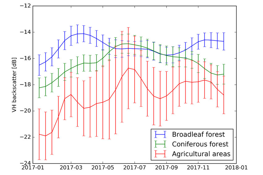
The figure above displays the backscatter values of a Sentinel-1 radar image over time. You can see that the three different land cover/use types vary significantly with regards to the measured backscatter intensity throughout the year. Here, the big advantage of multitemporal information can be demonstrated. When not solely looking at a single time step, but the dynamic for a class or a pixel, we are able to distinguish land cover/use types, which appear extremely similar for certain times of the year.
Temporal dynamics
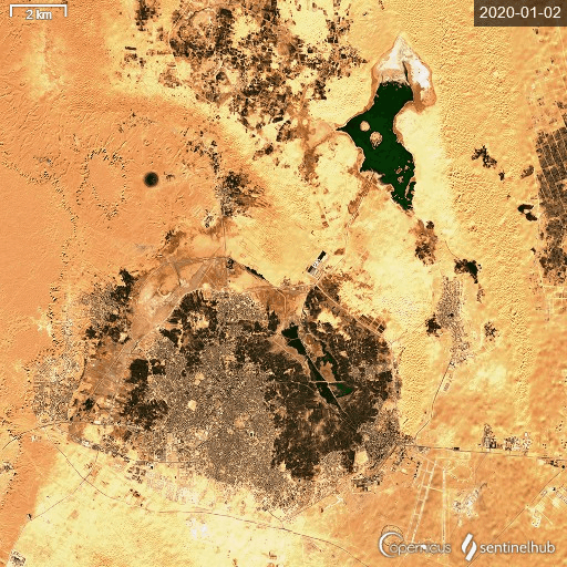
In the image on the lower left, you can see the significant changes occurring in Ouargla, Algeria. Water levels change drastically as evaporation leads to a water loss at the ground. While rains bring the water back to this oasis during the inter-annual wet seasons, water availability is a crucial parameter for surviving in this area. Satellites with high temporal resolution (Sentinel-2, in this case) can help to prevent locals from arising water shortages. Near the Equator, Sentinel-2 can reach revisit rates of up to 5 days, allowing the observation of rapidly occurring changes. Other satellites with lower temporal resolution (optical or SAR) are, therefore, less suited for disaster monitoring.
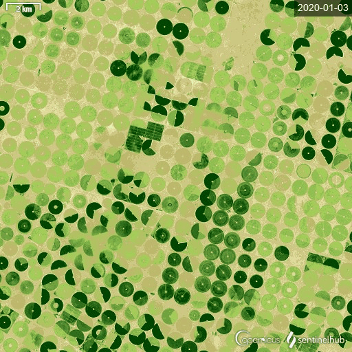
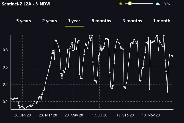
Another great application of high-resolution (spatial and temporal) Sentinel-2 data can be seen in the lower right. Pivot irrigation systems are a very effective way to cultivate areas that are naturally not suited for intensive agriculture. The pivots have a strong intra- and interannual range in vegetation cover. Located in the Saudi Arabian desert, these installations can be seen from space!
How do satellite constellations impact the revisit rate?
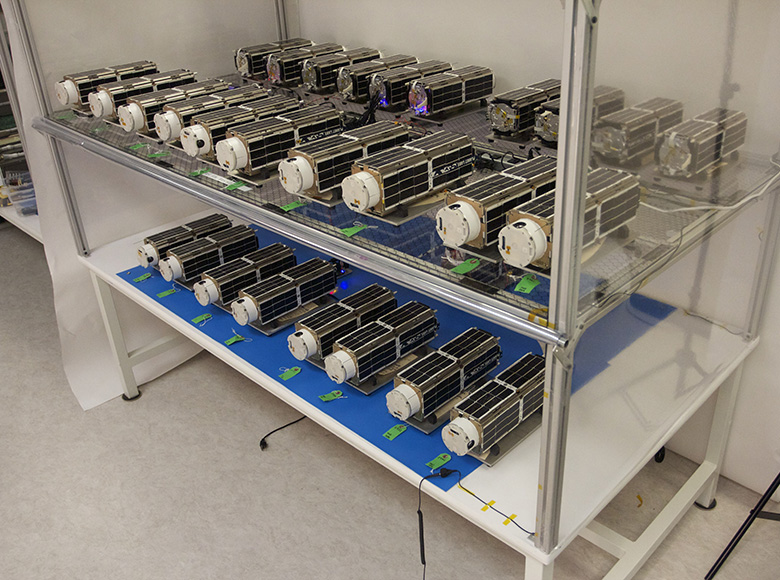
The temporal resolution of satellites depends on a number of factors. Orbiting satellites (travel time ≠ Earth rotation) take more time to revisit the same area as geostationary satellites (travel time = Earth rotation). Most Earth observation satellites are following quasi-polar orbits. Higher temporal resolution can be reached with geostationary satellites (travel time equals the Earth’s rotation). One example for geostationary acquisition are weather satellites such as EUMETSAT and GOES. With higher flight altitudes, satellites can travel more quickly around the Earth. While this is related to less spatial resolution, the temporal resolution is increased. Newer generations of satellites, such as the Sentinel fleet, have started to operate in chain constellations, increasing the temporal resolution by utilizing more satellites of the identical design. For example, the revisit rate of Sentinel-1A was increased by launching Sentinel-1B in April 2016 from 12 days to 6 days at the Equator. This trend is currently drastically increasing the number of satellites in space.
Sources & further reading
Dostálova, A., Lang, M., Ivanovs, J., Waser, L.T. & Wagner, W. (2021). European Wide Forest Classification Based on Sentinel-1 Data. Remote Sensing 13, 337. https://doi.org/10.3390/rs13030337.
Elachi, C. & van Zyl, J. (2015²). Introduction to the Physics and Techniques of Remote Sensing. Hoboken, USA: John Wiley & Sons, Inc.
Jensen, J.R. (2007²). Remote Sensing of the Environment. An Earth Resource Perspective. Upper Saddle River, USA: Pearson Prentice Hall.
Künzer, C., Dech, S. & Wagner, W. (2015). Remote Sensing Time Series. Revealing Land Surface Dynamics. Berlin, Germany: Springer.
Planet Labs (2021). Our Approach. <https://www.planet.com/company/approach/>.
Rees, W.G. (2010²). Physical Principles of Remote Sensing. Cambridge, USA: Cambridge University Press.
Schowengerdt, R.A. (2007³). Remote Sensing. Models and Methods for Image Processing. San Diego, USA: Academic Press.