

Learning objectives of this topic
- Introduction to radiometric resolution
- Radiometric representation
- Interdependencies between remote sensing resolutions
Last but not least, we will introduce you to the radiometric resolution. While the spectral resolution decides how much of the EM spectrum a sensor ‘sees’, the radiometric domain defines the number of gradients that are measured.
What is radiometric resolution?
The radiometric domain is also referred to as ‘color depth’ and is defined as the sensitivity to the magnitude of the EM energy. Thus, it characterizes how finely a given sensor can receive and divide the radiance between the different bands. Explore the animation on the right to investigate the difference between lower and higher radiometric at comparable spatial resolution. A greater resolution increases the range of intensities that a sensor can distinguish.
Comparison of different radiometric resolutions, left: lower, right: higher. Source: ESA 2009
How the spectral domain is represented
Typically, the radiometric resolution is expressed in bits. The bit count is used for characterizing numbers in the binary data format and each bit relates to an exponent of power 2 (e.g., 4 bit = 24, 0-15), which is the number of levels of grey values that are being recorded. This value is given for each band. Former remote sensing data sets were recorded (mostly) in 8-bit format. The latest optical sensors, such as Landsat 8 & Sentinel-2 (L2A), come with 12-bit data products. An image channel with 12-bit data is recording 212 (4,096) grey level values or shades of that given wavelength. Consequently, the level of detail in remotely sensed data strongly depends on the bit depth in which the data was recorded.
| Bit | 1 | 2 | 4 | 6 | 8 | 10 | 12 |
| # of possible grey values | 2 | 4 | 16 | 64 | 256 | 1,024 | 4,096 |

The trade-off between resolutions
To finalize this lesson on the different resolution in remote sensing we want to take a quick look at the relations between the different domains and how they interact with each other. The fact that the instruments we are using always use a certain combination of the resolutions given on the right makes every sensor and its acquired data unique. Given this knowledge, planning new sensors always has to be accomplished with an exact idea of what the instruments should sense on our land surfaces.
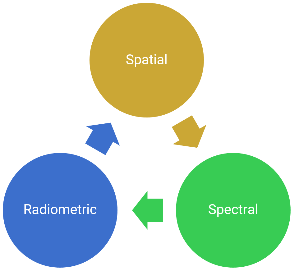
To achieve high radiometric resolution, a greater instantaneous field of view (IFOV) is beneficial, which in turn, would reduce the spatial resolution. If we want to get to a greater spatial resolution, we would need to engineer our sensor with a smaller IFOV. The spectral resolution on the other side can only be maximized, when we favor smaller bands (fewer wavelengths) over the increase of spatial resolution. Temporal resolution is also depending on the design of the sensor and the orbit characteristics of the satellite, which in turn also alters the spatial resolution. Hence, you can see that designing the right sensor tailored to your specific application is crucial but complex, especially in theory.
A classic example of a real-life situation where this interdependence can become somewhat problematic is the observation of, e.g., tree species. While it is very important to use data with high spatial resolution, the trade-off here is, that the spectral resolution which is essential to discriminate between different species (e.g., types of deciduous trees) is too coarse.
Keep this relation in mind in order to choose the correct sensor for your specific remote sensing application.
Sources & further reading
Elachi, C. & van Zyl, J. (2015²). Introduction to the Physics and Techniques of Remote Sensing. Hoboken, USA: John Wiley & Sons, Inc.
European Space Agency (ESA, 2009). Remote Sensing Principles. <https://www.esa.int/Education/Eduspace>.
Jensen, J.R. (2007²). Remote Sensing of the Environment. An Earth Resource Perspective. Upper Saddle River, USA: Pearson Prentice Hall.
Rees, W.G. (2010²). Physical Principles of Remote Sensing. Cambridge, USA: Cambridge University Press.
Schowengerdt, R.A. (2007³). Remote Sensing. Models and Methods for Image Processing. San Diego, USA: Academic Press.