
How much forest do we have on Earth?
Forests are of extraordinary importance for our planet. Besides their function as habitat for countless species and as a reservoir for wood as a valuable resource, they act as carbon sinks and are therefore of utmost importance for the carbon cycle and the stability of our climate.
Forest monitoring is one of the classic application fields of radar remote sensing, with countless examples of use. This topic will give you a brief insight into the forest parameters that can be monitored with radar, why this is necessary and which methods are used.

By loading the video, you agree to YouTube’s privacy policy.
Learn more
How a radar sees a forest
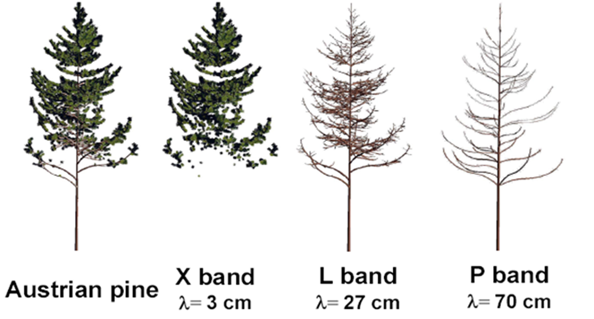
In order to understand how a forest looks in a radar image, you have to remember that the microwaves interact with objects whose size is approximately on the same scale as the wavelength. In other words, a tree can look very different, depending on the radar wavelength the satellite is using:

| Frequency Band | X-Band | C-Band | L-Band | P-Band |
|---|---|---|---|---|
| Main Scatterers | Leaves, Twigs | Leaves, small branches | Branches | Branches & Trunk |
© Thuy Le Toan
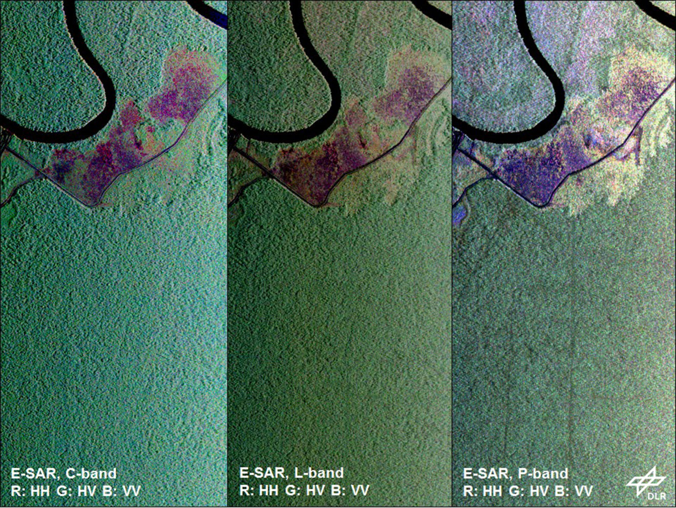
Very dense rainforest
The following example demonstrates the differences in using various wavelengths in a dense rainforest in Kalimantan, Indonesia.
Popular Forest applications
Forests create versatile landscapes. The methods of radar remote sensing that are used to map forest parameters, are just as manifold. The entire spectrum of possible techniques is applied to derive information about the amount, extent and state of the Earth’s forests. Here are some examples:
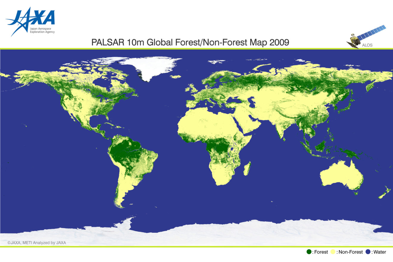
Forest Map
A typical application, that is operationally used, is the mapping of forest extent, and building on that, mapping the changes in forest cover over time. This information is crucial to estimate how much forest is lost due to logging or how much is regained through planting new forest or regrowth, respectively. You will learn how to derive a forest map in the upcoming tutorial.
Tree height
Tree height is an important parameter to estimate e.g. the age of forest stands or as a precursor to derive forest biomass. Tree height can be estimated by a method that utilises a combination of interferometric and polarimetric information, called PolInSAR.
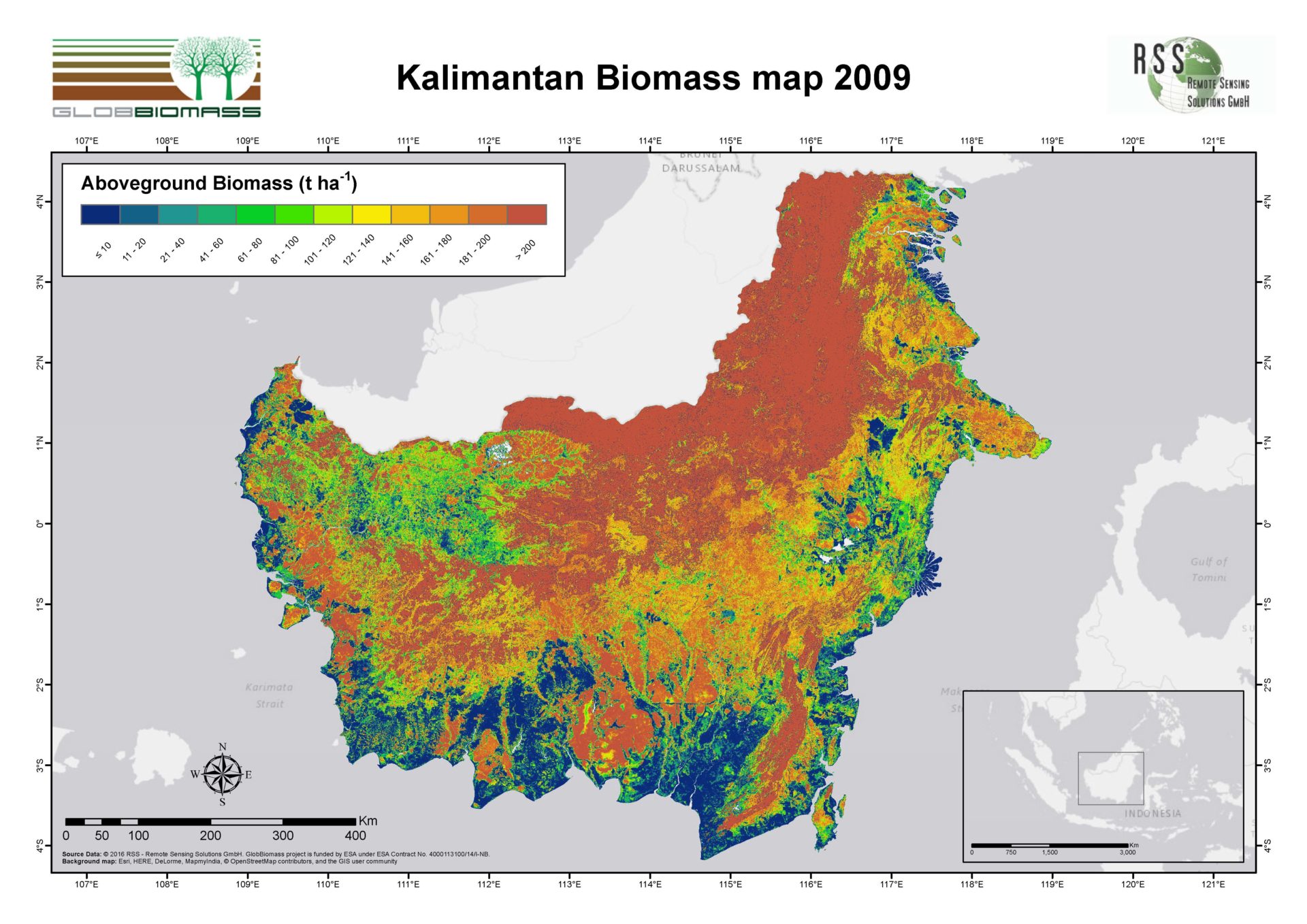
Biomass
Biomass is a crucial parameter in our understanding of the carbon cycle and a major factor in the stability of our climate. Mapping the above ground biomass is one major application of radar remote sensing techniques. Nowadays, science is aiming at the production of global biomass maps with a frequent update rate, made possible with radar.
More details
The resource repository holds a comprehensive presentation for a deeper understanding of biomass mapping with radar.
We recommend this resource for users who would like to delve deeper into the topic.
FOREST Tutorial
FOREST MAPPING
With ALOS PALSAR Mosaics

In this tutorial you are going to learn how to map forest areas with the help of ALOS PALSAR data. You will use SNAP to process two images with two polarisations of the Para region in the Amazon. According to the WWF, over 17 % of forest has been lost in the Amazon within the past 50 years.
You will learn how to derive a forest/non-forest map by using two time steps and two radar polarisations (HH/HV).
Preparation
In order to do this tutorial, you have to make sure you’ve installed SNAP. If you did not, please go back to lesson 2 and follow the instructions in the topic Introduction to SNAP.
Get the data
For this tutorial you can download a prepared data set here. The data is packed in one ZIP archive and already subsetted for you.
Data providedy by:
You can obtain global ALOS PALSAR mosaics and global forest/non-forest maps here. (After registration)
In case you have a slow internet connection, you can alternatively download a subset of the above mentioned data here.
Tutorial
By loading the video, you agree to YouTube’s privacy policy.
Learn more